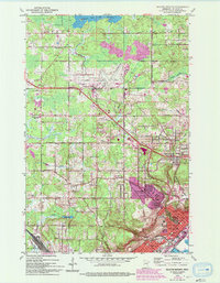
1953 Map of Duluth Heights
USGS Topo · Published 1993About this map
The Duluth International Airport serves as a massive focal point northwest of the city, illustrating the mid-century expansion of aviation infrastructure in St. Louis County. This 1953 survey, later updated with 1991 aerial revisions, shows the transition from the industrial port character of Duluth to the burgeoning residential and municipal developments in Hermantown and Proctor. The landscape is a network of water and rail, defined by the Duluth Missabe and Iron Range RR and the Midway River.
Find a feature on this map
43 named features on this map. Tap any name to fly to it.
Don’t see what you’re looking for? This feature index may not catch every label — zoom into the map to look around manually.
Map Details
Editions of this 1953 Duluth Heights Map
5 editions found
Other maps of this area

1895 · Duluth
USGS Topo · 1:62,500

1915 · Superior
USGS Topo · 1:48,000

1917 · Superior
USGS Topo · 1:62,500

1953 · Twig
USGS Topo · 1:24,000

1953 · Adolph
USGS Topo · 1:24,000

1953 · Arnold
USGS Topo · 1:24,000

1953 · Duluth
USGS Topo · 1:24,000

1953 · Duluth Heights
USGS Topo · 1:24,000

1953 · Fredenberg
USGS Topo · 1:24,000

1953 · Duluth
USGS Topo · 1:62,500