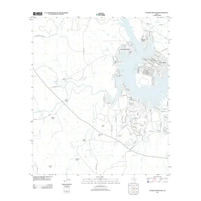
2012 Map of Dunman Mountain
USGS Topo · Published 2012About this map
Sunrise Beach Village and Highland Haven occupy the jagged peninsula and shoreline of Lake Lyndon B Johnson, a landscape defined by the convergence of the Llano and Colorado Rivers. This modern survey illustrates the dense residential development along the waterfront, contrasting sharply with the expansive ranchlands and rugged hill country to the south and west. Significant landmarks include the Sunrise Beach Airport and a series of prominent peaks and depressions, such as Packsaddle Mountain, Dunman Mtn, and the distinctive Lime Hollow. Rural heritage is preserved in the location of Wolf Crossing Cem and Pecan Cem, while the drainage network of Sandy Cr and Walnut Cr continues to shape the local geography. The map provides a clear picture of how water access transformed this portion of the Texas Hill Country into a hub for recreation and lakeside living.
Find a feature on this map
46 named features on this map. Tap any name to fly to it.
Don’t see what you’re looking for? This feature index may not catch every label — zoom into the map to look around manually.
Map Details
Editions of this 2012 Dunman Mountain Map
This is the sole edition of this map. No revisions or reprints were ever made.
Other maps of this area

1887 · Llano
USGS Topo · 1:125,000

1887 · Blanco
USGS Topo · 1:125,000

1887 · Burnet
USGS Topo · 1:125,000

1893 · Burnet
USGS Topo · 1:125,000

1894 · Fredericksburg
USGS Topo · 1:125,000

1894 · Blanco
USGS Topo · 1:125,000

1894 · Llano
USGS Topo · 1:125,000

1903 · Burnet
USGS Topo · 1:125,000

1904 · Llano
USGS Topo · 1:125,000

1909 · Llano
USGS Topo · 1:125,000