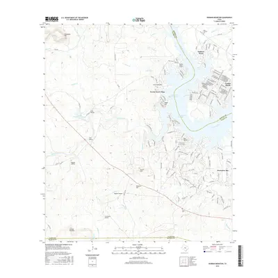
2016 Map of Dunman Mountain
USGS Topo · Published 2016About this map
Lake Lyndon B Johnson serves as the focal point for this section of the Texas Hill Country, where the Colorado River meets a series of residential developments and rugged upland terrain. The map illustrates the 2016 layout of established lakeside communities like Granite Shoals and Sunrise Beach Village, which are characterized by dense networks of local roads such as E Lakeshore Dr and Sunrise Dr. This period shows a landscape transitioning from traditional ranching lands into a recreation-oriented economy, exemplified by the Sunrise Beach Airport and the complex shoreline of Horseshoe Bay.
Find a feature on this map
154 named features on this map. Tap any name to fly to it.
Don’t see what you’re looking for? This feature index may not catch every label — zoom into the map to look around manually.
Map Details
Editions of this 2016 Dunman Mountain Map
This is the sole edition of this map. No revisions or reprints were ever made.
Other maps of this area

1887 · Llano
USGS Topo · 1:125,000

1887 · Blanco
USGS Topo · 1:125,000

1887 · Burnet
USGS Topo · 1:125,000

1893 · Burnet
USGS Topo · 1:125,000

1894 · Fredericksburg
USGS Topo · 1:125,000

1894 · Blanco
USGS Topo · 1:125,000

1894 · Llano
USGS Topo · 1:125,000

1903 · Burnet
USGS Topo · 1:125,000

1904 · Llano
USGS Topo · 1:125,000

1909 · Llano
USGS Topo · 1:125,000