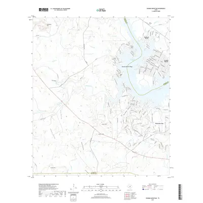
2019 Map of Dunman Mountain
USGS Topo · Published 2019About this map
Lake Lyndon B Johnson and the Colorado River serve as the focal point for this region of the Texas Hill Country, where water-oriented residential development meets ranching terrain. The map details the lakeside communities of Sunrise Beach Village, Highland Haven, and Granite Shoals, showing a transition from the rugged limestone heights of Packsaddle Mtn and Dunman Mtn to the shoreline's dense network of neighborhood streets. Farther south, the expansive resort development of Horseshoe Bay dominates the lower reach of the lake. Historical markers and genealogy points are scattered throughout the brushy landscape, including Wolf Crossing Cem near the Burnet County line and Pecan Cem south of E State Hwy 71. The terrain is deeply dissected by drainages such as Sandy Creek and Walnut Cr, creating numerous hollows like Hogpen Hollow and Ship Hollow that define the local topography.
Find a feature on this map
49 named features on this map. Tap any name to fly to it.
Don’t see what you’re looking for? This feature index may not catch every label — zoom into the map to look around manually.
Map Details
Editions of this 2019 Dunman Mountain Map
This is the sole edition of this map. No revisions or reprints were ever made.
Other maps of this area

1887 · Llano
USGS Topo · 1:125,000

1887 · Blanco
USGS Topo · 1:125,000

1887 · Burnet
USGS Topo · 1:125,000

1893 · Burnet
USGS Topo · 1:125,000

1894 · Fredericksburg
USGS Topo · 1:125,000

1894 · Blanco
USGS Topo · 1:125,000

1894 · Llano
USGS Topo · 1:125,000

1903 · Burnet
USGS Topo · 1:125,000

1904 · Llano
USGS Topo · 1:125,000

1909 · Llano
USGS Topo · 1:125,000