
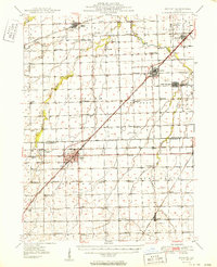
1950 Map of Dwight
USGS Topo · Published 1950About this map
The State Reformatory for Women stands as a prominent institution just west of Dwight, illustrating the intersection of state social infrastructure and the rural landscape at mid-century. This region, spanning the border of Grundy and Livingston counties, is defined by an extensive network of small country schools that served a thriving agricultural population. Notable examples include the Old Mazon School and the Danish School, reflecting the local ethnic and civic history of the area.
Find a feature on this map
67 named features on this map. Tap any name to fly to it.
Don’t see what you’re looking for? This feature index may not catch every label — zoom into the map to look around manually.
Map Details
Editions of this 1950 Dwight Map
2 editions found
Other maps of this area

1892 · Morris
USGS Topo · 1:62,500

1892 · Marseilles
USGS Topo · 1:62,500

1892 · Wilmington
USGS Topo · 1:62,500

1916 · Marseilles
USGS Topo · 1:62,500

1918 · Wilmington
USGS Topo · 1:62,500

1918 · Morris
USGS Topo · 1:62,500

1923 · Herscher
USGS Topo · 1:62,500

1925 · Herscher
USGS Topo · 1:62,500

1935 · Pontiac
USGS Topo · 1:62,500

1939 · Pontiac
USGS Topo · 1:62,500