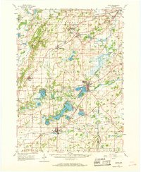
1960 Map of Eagle
USGS Topo · Published 1968About this map
Kettle Moraine State Forest dominates the western landscape of this mid-century survey, its glacial topography punctuated by a dense network of kettle lakes such as Pretty Lake and Ottawa Lake. The region is defined by its transition from these wooded moraines to the fertile river valleys of the Fox River and Mukwonago River. Small villages and rail stops like North Prairie and Genesee Depot reflect the established agricultural and transit patterns of Waukesha County, while religious and educational institutions, including the Divine Word Seminary near Lake Beulah, show the area's development as a center for community life.
Find a feature on this map
103 named features on this map. Tap any name to fly to it.
Don’t see what you’re looking for? This feature index may not catch every label — zoom into the map to look around manually.
Map Details
Editions of this 1960 Eagle Map
3 editions found
Other maps of this area

1891 · Muskego
USGS Topo · 1:62,500

1892 · Waukesha
USGS Topo · 1:62,500

1892 · Watertown
USGS Topo · 1:62,500

1892 · Oconomowoc
USGS Topo · 1:62,500

1892 · Whitewater
USGS Topo · 1:62,500

1892 · Eagle
USGS Topo · 1:62,500

1893 · Delavan
USGS Topo · 1:62,500

1893 · Whitewater
USGS Topo · 1:62,500

1893 · Silver Lake
USGS Topo · 1:62,500

1893 · Geneva
USGS Topo · 1:62,500