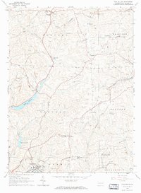
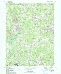
1964 Map of East Butler
USGS Topo · Published 1973About this map
Bessemer and Lake Erie railroad tracks cut a prominent path through this 1960s industrial and agricultural landscape in Butler County. The map captures a transition in local infrastructure, showing the extensive network of oil wells and strip mines that defined the regional economy alongside emerging recreational spaces like the Hunting and Fishing Club and a local Golf Course. Numerous small settlements and junctions are documented, including Greece City, Hooker, and St Joe, reflecting the late-century rural settlement pattern before modern suburban expansion.
Find a feature on this map
43 named features on this map. Tap any name to fly to it.
Don’t see what you’re looking for? This feature index may not catch every label — zoom into the map to look around manually.
Map Details
Editions of this 1964 East Butler Map
5 editions found
Other maps of this area

1900 · Kittanning
USGS Topo · 1:62,500

1902 · Kittanning
USGS Topo · 1:62,500

1907 · Foxburg
USGS Topo · 1:62,500

1908 · Foxburg
USGS Topo · 1:62,500

1909 · Butler
USGS Topo · 1:62,500

1910 · Hilliards
USGS Topo · 1:62,500

1911 · Butler
USGS Topo · 1:62,500

1912 · Hilliards
USGS Topo · 1:62,500

1944 · Hilliards
USGS Topo · 1:62,500

1953 · Pittsburgh
USGS Topo · 1:250,000