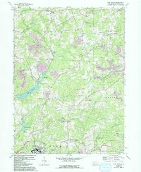
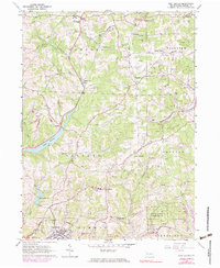
1964 Map of East Butler
USGS Topo · Published 1993About this map
The oil and gas industry of Butler County is prominently etched across the landscape of this 1960s survey, updated with revisions from the late 1980s. Dense clusters of oil wells dominate the townships of Concord and Fairview, tracing a historical pattern of extraction that defined local development. The industrial character of the region is further punctuated by a tipple and several strip mines, contrasting with the recreational and conservation spaces found at the Golf Course and the expansive State Game Lands No 164 in the south.
Find a feature on this map
37 named features on this map. Tap any name to fly to it.
Don’t see what you’re looking for? This feature index may not catch every label — zoom into the map to look around manually.
Map Details
Editions of this 1964 East Butler Map
5 editions found
Other maps of this area

1900 · Kittanning
USGS Topo · 1:62,500

1902 · Kittanning
USGS Topo · 1:62,500

1907 · Foxburg
USGS Topo · 1:62,500

1908 · Foxburg
USGS Topo · 1:62,500

1909 · Butler
USGS Topo · 1:62,500

1910 · Hilliards
USGS Topo · 1:62,500

1911 · Butler
USGS Topo · 1:62,500

1912 · Hilliards
USGS Topo · 1:62,500

1944 · Hilliards
USGS Topo · 1:62,500

1953 · Pittsburgh
USGS Topo · 1:250,000