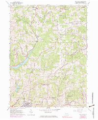
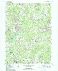
1964 Map of East Butler
USGS Topo · Published 1983About this map
Greece City and Hooker anchor the northern landscape of this Butler County region, where the industrial and natural worlds meet. The terrain is defined by the winding course of Connoquenessing Creek and the significant water bodies of Lake Oneida and Thorn Reservoir. Transportation and extraction history are prominent, with the Bessemer and Lake Erie railroad corridor cutting through the hills alongside numerous oil wells and a strip mine.
Find a feature on this map
39 named features on this map. Tap any name to fly to it.
Don’t see what you’re looking for? This feature index may not catch every label — zoom into the map to look around manually.
Map Details
Editions of this 1964 East Butler Map
5 editions found
Other maps of this area

1900 · Kittanning
USGS Topo · 1:62,500

1902 · Kittanning
USGS Topo · 1:62,500

1907 · Foxburg
USGS Topo · 1:62,500

1908 · Foxburg
USGS Topo · 1:62,500

1909 · Butler
USGS Topo · 1:62,500

1910 · Hilliards
USGS Topo · 1:62,500

1911 · Butler
USGS Topo · 1:62,500

1912 · Hilliards
USGS Topo · 1:62,500

1944 · Hilliards
USGS Topo · 1:62,500

1953 · Pittsburgh
USGS Topo · 1:250,000