
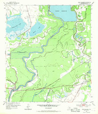
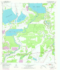
1952 Map of East Columbia
USGS Topo · Published 1953About this map
The Brazos River carves a deep, winding path through the bottomlands of Brazoria County, defining a landscape of oxbow lakes and alluvial basins. Near the settlement of East Columbia, the river’s influence is seen in the dense network of named water bodies, including Eagle Nest Lake, Manor Lake, and Harris Reservoir. A notable mid-century development is the presence of Mann Lake (Under Construction), with its proposed water level of 33 feet carefully delineated behind a new Levee. This era shows the region balancing its agricultural roots with industrial expansion, evidenced by numerous Oil Wells and a complex system of Pipe Lines crossing the terrain.
Find a feature on this map
39 named features on this map. Tap any name to fly to it.
Don’t see what you’re looking for? This feature index may not catch every label — zoom into the map to look around manually.
Map Details
Editions of this 1952 East Columbia Map
3 editions found
Other maps of this area

1943 · Rosharon
USGS Topo · 1:31,680

1943 · Angleton
USGS Topo · 1:24,000

1943 · Snipe
USGS Topo · 1:31,680

1950 · Houston
USGS Topo · 1:250,000

1952 · West Columbia
USGS Topo · 1:24,000

1952 · Sweeny
USGS Topo · 1:24,000

1952 · Brazoria
USGS Topo · 1:24,000

1953 · Damon
USGS Topo · 1:24,000

1953 · Otey
USGS Topo · 1:24,000

1956 · Houston
USGS Topo · 1:250,000
Featured Places
- Holiday Lakes, TX
- Bailey Prairie, Bailey's Prairie
- East Columbia, TX
- Bailey's Prairie, TX
- Brazoria County, TX