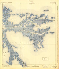
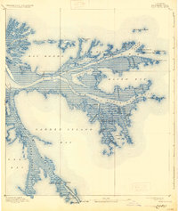
1893 Map of East Delta
USGS Topo · Published 1924About this map
Port Eads and Balize anchor this late nineteenth-century maritime study of the Mississippi River's mouth, where the delta splays into the Gulf of Mexico. This map, based on 1891 surveys, captures the complex hydrology of the bird's-foot delta before modern coastal erosion significantly altered these landforms. Notable navigation aids and outposts such as the Pass A Loutre Light, Revenue Station, and South Pass Light mark the treacherous channels where river traffic met the sea.
Find a feature on this map
44 named features on this map. Tap any name to fly to it.
Don’t see what you’re looking for? This feature index may not catch every label — zoom into the map to look around manually.
Map Details
Editions of this 1893 East Delta Map
6 editions found
Other maps of this area

1893 · East Delta
USGS Topo · 1:62,500

1893 · Forts
USGS Topo · 1:62,500

1893 · West Delta
USGS Topo · 1:62,500

1935 · Garden Island Pass
USGS Topo · 1:31,680

1935 · South Pass
USGS Topo · 1:31,680

1946 · Mudpan Bayou
USGS Topo · 1:31,680

1947 · Garden Island Pass
USGS Topo · 1:31,680

1947 · Pass A Loutre West
USGS Topo · 1:31,680

1947 · Venice
USGS Topo · 1:31,680

1947 · Southwest Pass
USGS Topo · 1:31,680