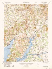
1942 Map of Elkton
USGS Topo · Published 1942About this map
Elkton Landing serves as a focal point for this 1942 survey, where the confluence of local commerce and complex hydrology defines the Cecil County landscape. The importance of maritime and rail transit is evident in the path of the Chesapeake & Delaware Canal and the tracks of the Pennsylvania and Baltimore and Ohio railroads, which linked these rural communities to the broader Mid-Atlantic corridor. The terrain transitions from the tidal reaches of the Northeast River and Back Creek to the rolling hills of the Nottingham and London Britain districts.
Find a feature on this map
79 named features on this map. Tap any name to fly to it.
Don’t see what you’re looking for? This feature index may not catch every label — zoom into the map to look around manually.
Map Details
Editions of this 1942 Elkton Map
4 editions found

Other maps of this area

1898 · Elkton
USGS Topo · 1:62,500

1898 · Tolchester
USGS Topo · 1:125,000

1899 · Dover
USGS Topo · 1:125,000

1900 · Elkton
USGS Topo · 1:62,500

1900 · Cecilton
USGS Topo · 1:62,500

1900 · Havre De Grace
USGS Topo · 1:62,500

1900 · Betterton
USGS Topo · 1:62,500

1901 · West Chester
USGS Topo · 1:62,500

1903 · Tolchester
USGS Topo · 1:125,000

1904 · West Chester
USGS Topo · 1:62,500