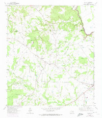
1964 Map of Elwood
USGS Topo · Published 1974About this map
Trinity River waters dominate the eastern edge of this 1964 survey, where the landscape is marked by the impending arrival of Lake Livingston. The map captures a moment of transition for the Madison and Leon county line, showing areas designated for controlled inundation up to the 135-foot contour. In the center, the community of Elwood and the nearby Old Elwood reflect a shifting local geography, while Alphin Cem and Wilson Chapel provide anchor points for genealogists tracing family histories in the area. The terrain is a network of small watercourses like Larrison Creek and Cobb Creek that feed into the river basin. Cultural landmarks such as the Tan Yard and the Community Building sit alongside evidence of industry, including scattered Oil Wells and a Gravel Pit. The historic Osr road cuts through the western portion, serving as a primary corridor through this creek-fed ranching and timber country.
Find a feature on this map
42 named features on this map. Tap any name to fly to it.
Don’t see what you’re looking for? This feature index may not catch every label — zoom into the map to look around manually.
Map Details
Editions of this 1964 Elwood Map
2 editions found
Other maps of this area

1953 · Palestine
USGS Topo · 1:250,000

1954 · Beaumont
USGS Topo · 1:250,000

1957 · Beaumont
USGS Topo · 1:250,000

1957 · Palestine
USGS Topo · 1:250,000

1962 · Connor
USGS Topo · 1:24,000

1962 · Baker Lake
USGS Topo · 1:24,000

1963 · Madisonville
USGS Topo · 1:24,000

1964 · Sand Ridge
USGS Topo · 1:24,000

1964 · Austonio
USGS Topo · 1:24,000

1964 · Middleton
USGS Topo · 1:24,000