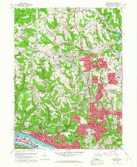
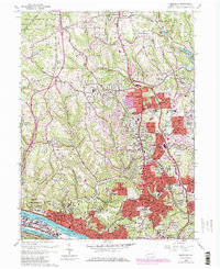
1960 Map of Emsworth
USGS Topo · Published 1968About this map
The Ohio River corridor and its surrounding northern suburbs show a landscape in transition, where established river towns meet the expanding residential tracts of the 1950s. Near the water, the Dixmont State Hospital and Emsworth Dam anchor the riverbank in Kilbuck, while the Pittsburgh and Lake Erie RR follows the southern shore. This era is marked by the presence of numerous religious and educational institutions, such as Mt Nazareth Academy and Vincentian High Sch, reflecting the community's growth. To the north, the sprawling acreage of North Park and the State Game Commission land provide a stark contrast to the burgeoning neighborhoods of Ingomar, Wexford, and Perrysville. Notable local landmarks like the Mt Nebo Grange Hall and several cemeteries, including Franklin Cem and the North Side Cemetery, offer significant details for genealogical research and local history studies.
Find a feature on this map
98 named features on this map. Tap any name to fly to it.
Don’t see what you’re looking for? This feature index may not catch every label — zoom into the map to look around manually.
Map Details
Editions of this 1960 Emsworth Map
5 editions found
Other maps of this area

1904 · Mc Keesport
USGS Topo · 1:62,500

1904 · Carnegie
USGS Topo · 1:62,500

1906 · Carnegie
USGS Topo · 1:62,500

1906 · Sewickley
USGS Topo · 1:62,500

1907 · Pittsburg
USGS Topo · 1:62,500

1908 · Sewickley
USGS Topo · 1:62,500

1908 · Carnegie
USGS Topo · 1:62,500

1908 · New Kensington
USGS Topo · 1:62,500

1910 · New Kensington
USGS Topo · 1:62,500

1948 · Pittsburgh West
USGS Topo · 1:24,000