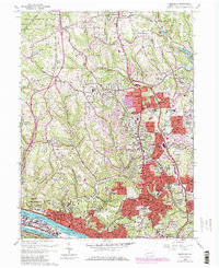
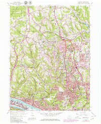
1960 Map of Emsworth
USGS Topo · Published 1980About this map
The Dixmont State Hospital overlooks the Ohio River in this 1960 era survey, illustrating the institutional and industrial landscape of Allegheny County. The map details the complex river engineering at the Emsworth Dam and the heavy transit corridor defined by the Pittsburgh and Lake Erie RR and the PA Turnpike. While river-level communities like Emsworth, Avalon, and Bellevue show established density, the northern hills near Ingomar and Wexford capture the era's rapid suburbanization, with purple revisions highlighting the expansion of neighborhoods like Highland and Berkeley Hills. Educational and religious landmarks are prominent throughout, from the Vincentian High Sch to the Mt Nazareth Academy, alongside family-history resources such as United Cem and Franklin Cem. This document preserves the spatial relationship between the river-valley industry and the growing residential ridges of the mid-20th century.
Find a feature on this map
77 named features on this map. Tap any name to fly to it.
Don’t see what you’re looking for? This feature index may not catch every label — zoom into the map to look around manually.
Map Details
Editions of this 1960 Emsworth Map
5 editions found
Other maps of this area

1904 · Mc Keesport
USGS Topo · 1:62,500

1904 · Carnegie
USGS Topo · 1:62,500

1906 · Carnegie
USGS Topo · 1:62,500

1906 · Sewickley
USGS Topo · 1:62,500

1907 · Pittsburg
USGS Topo · 1:62,500

1908 · Sewickley
USGS Topo · 1:62,500

1908 · Carnegie
USGS Topo · 1:62,500

1908 · New Kensington
USGS Topo · 1:62,500

1910 · New Kensington
USGS Topo · 1:62,500

1948 · Pittsburgh West
USGS Topo · 1:24,000