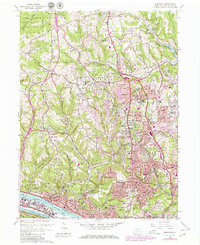
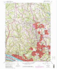
1960 Map of Emsworth
USGS Topo · Published 1980About this map
The Ohio River corridor and its surrounding hills define this 1960 landscape, showing the suburban expansion of northern Allegheny County before the full maturation of the interstate system. Settlements like West View, Avalon, and Emsworth cluster near the river and Back Channel, while the northern reaches of McCandless and Franklin township show a transition toward more pastoral uses and emerging residential developments.
Find a feature on this map
77 named features on this map. Tap any name to fly to it.
Don’t see what you’re looking for? This feature index may not catch every label — zoom into the map to look around manually.
Map Details
Editions of this 1960 Emsworth Map
5 editions found
Other maps of this area

1904 · Mc Keesport
USGS Topo · 1:62,500

1904 · Carnegie
USGS Topo · 1:62,500

1906 · Carnegie
USGS Topo · 1:62,500

1906 · Sewickley
USGS Topo · 1:62,500

1907 · Pittsburg
USGS Topo · 1:62,500

1908 · Sewickley
USGS Topo · 1:62,500

1908 · Carnegie
USGS Topo · 1:62,500

1908 · New Kensington
USGS Topo · 1:62,500

1910 · New Kensington
USGS Topo · 1:62,500

1948 · Pittsburgh West
USGS Topo · 1:24,000