Loading...
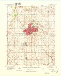
Loading map...1955 Map of Enid
USGS Topo · Published 1975About this map
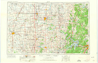
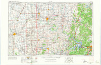
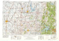
The Osage Indian Reservation dominates the eastern half of this landscape, characterized by rolling uplands and the winding courses of the Arkansas River and Caney River. To the west, the flat plains are gridded by an extensive network of roads and rail lines, including the Atchison Topeka and Santa Fe RR and the Chicago Rock Island and Pacific RR. These transportation corridors link major agricultural and industrial centers like Enid, Ponca City, and Stillwater.
Find a feature on this map
183 named features on this map. Tap any name to fly to it.
Don’t see what you’re looking for? This feature index may not catch every label — zoom into the map to look around manually.
Map Details
Date Portrayed1955
Date Published1975
PublisherU.S. Geological Survey
Map TypeTopographic
Scale1:250,000
Physical Dimensions34.6 x 22.2 inches
Editions of this 1955 Enid Map
4 editions found

Historical Maps of Tulsa Through Time
4 maps found


Featured Locations
Source Details
SourceU.S. Geological Survey
CopyrightPublic Domain