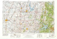
1955 Map of Enid
USGS Topo · Published 1978About this map
Osage Indian Reservation dominates the eastern half of this landscape, characterized by the Osage Hills and a network of creeks feeding the Arkansas River. By the late 1970s, the geography was significantly altered by large-scale water management projects, including Kaw Lake on the Arkansas and Keystone Lake near Tulsa. These reservoirs submerged older river bottoms while creating new recreational shorelines adjacent to established towns like Ponca City and Bartlesville.
Find a feature on this map
231 named features on this map. Tap any name to fly to it.
Don’t see what you’re looking for? This feature index may not catch every label — zoom into the map to look around manually.
Map Details
Editions of this 1955 Enid Map
4 editions found

Other maps of this area

1885 · Sedan
USGS Topo · 1:125,000

1886 · Independence
USGS Topo · 1:125,000

1889 · Burden
USGS Topo · 1:125,000

1889 · Anthony
USGS Topo · 1:125,000

1889 · Sedan
USGS Topo · 1:125,000

1889 · Caldwell
USGS Topo · 1:125,000

1890 · Wellington
USGS Topo · 1:125,000

1891 · Anthony
USGS Topo · 1:125,000

1892 · Guthrie
USGS Topo · 1:62,500

1892 · Kingfisher
USGS Topo · 1:125,000