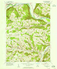
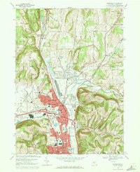
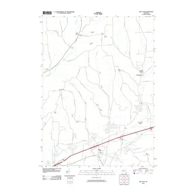
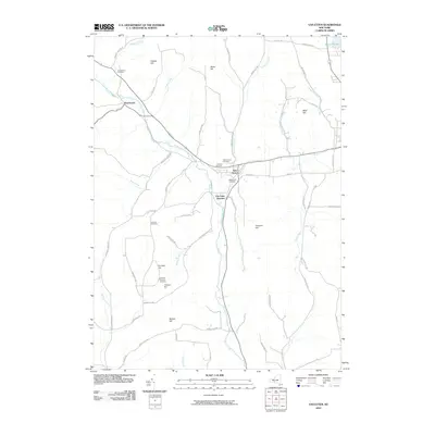
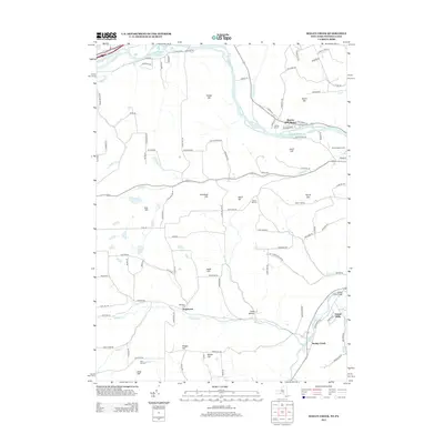
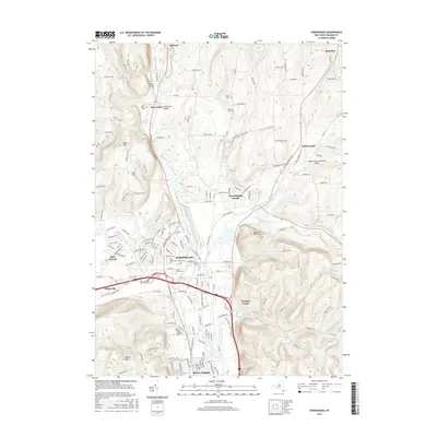
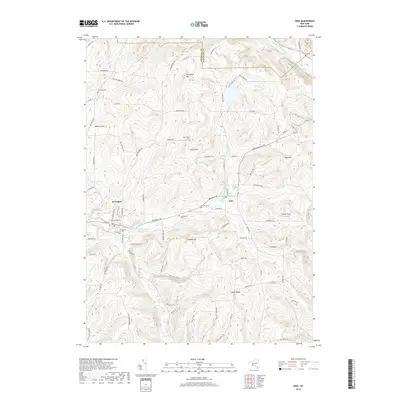
1969 Map of Erin
USGS Topo · Published 1986About this map
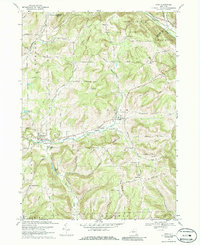
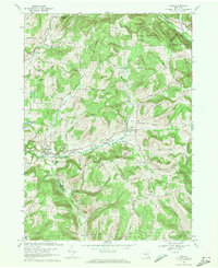
Newtown Creek and Baldwin Creek carve through the upland terrain of Chemung County, defining a landscape marked by narrow valleys and prominent ridges like Tuthill Ridge and Austin Hill. The 1969 landscape reveals a series of historic rural nodes including Erin, South Erin, and Breesport, with the latter featuring local industrial activity at several Gravel Pits. Local history is deeply etched into the topography through a high density of family and community burial grounds, such as the Old Scotchtown Cem, Red Chalk Cem, and Van Duzer Cem. A notable social landmark, the County Home and Infirmary, sits along the creek west of Breesport. The road network, including the Lehigh Valley Road and Park Station Road, follows the natural contours of the hills, connecting isolated farms and homes to the primary valley settlements.
Find a feature on this map
64 named features on this map. Tap any name to fly to it.
Don’t see what you’re looking for? This feature index may not catch every label — zoom into the map to look around manually.
Map Details
Editions of this 1969 Erin Map
2 editions found
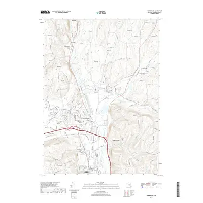
Historical Maps of Horseheads Through Time
36 maps found
1953 Big Flats
Chemung County, NY
1953 Horseheads
Chemung County, NY
1953 Seeley Creek
Chemung County, NY
1954 Erin
Chemung County, NY
1954 Van Etten
Chemung County, NY
1969 Big Flats
Chemung County, NY
1969 Erin
Chemung County, NY
1969 Horseheads
Chemung County, NY
1969 Seeley Creek
Chemung County, NY
1969 Van Etten
Chemung County, NY
1978 Horseheads
Chemung County, NY
2010 Big Flats
Chemung County, NY
2010 Erin
Chemung County, NY
2010 Horseheads
Chemung County, NY
2010 Seeley Creek
Chemung County, NY
2010 Van Etten
Chemung County, NY
2013 Big Flats
Chemung County, NY
2013 Erin
Chemung County, NY
2013 Horseheads
Chemung County, NY
2013 Seeley Creek
Chemung County, NY
2013 Van Etten
Chemung County, NY
2016 Big Flats
Chemung County, NY
2016 Erin
Chemung County, NY
2016 Horseheads
Chemung County, NY
2016 Seeley Creek
Chemung County, NY
2016 Van Etten
Chemung County, NY
2019 Big Flats
Chemung County, NY
2019 Erin
Chemung County, NY
2019 Horseheads
Chemung County, NY
2019 Seeley Creek
Chemung County, NY
2019 Van Etten
Chemung County, NY

2023 Big Flats
Chemung County, NY

2023 Erin
Chemung County, NY

2023 Horseheads
Chemung County, NY

2023 Seeley Creek
Chemung County, NY

2023 Van Etten
Chemung County, NY