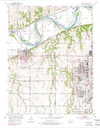
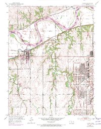
1951 Map of Eudora
USGS Topo · Published 1978About this map
The confluence of the Wakarusa River and the Kansas River anchors this landscape, where the town of Eudora grew at the intersection of river transport and rail. By the mid-20th century, the landscape reflects a shift toward industrial and military use, most notably with the massive footprint of the Sunflower Ordnance Works dominating the eastern half of the map. This facility, complete with an Acid Disposal area and internal rail networks, transformed the rural character of the land near Clearview City.
Find a feature on this map
30 named features on this map. Tap any name to fly to it.
Don’t see what you’re looking for? This feature index may not catch every label — zoom into the map to look around manually.
Map Details
Editions of this 1951 Eudora Map
6 editions found
Other maps of this area

1885 · Lawrence
USGS Topo · 1:125,000

1886 · Oskaloosa
USGS Topo · 1:125,000

1887 · Olathe
USGS Topo · 1:125,000

1888 · Oskaloosa
USGS Topo · 1:125,000

1889 · Lawrence
USGS Topo · 1:125,000

1890 · Kansas City
USGS Topo · 1:125,000

1893 · Olathe
USGS Topo · 1:125,000

1894 · Kansas City
USGS Topo · 1:125,000

1894 · Oskaloosa
USGS Topo · 1:125,000

1934 · Bonner Springs
USGS Topo · 1:48,000