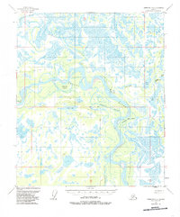
1950 Map of Fairbanks D-5
USGS Topo · Published 1985About this map
The Tanana River carves a complex course through this interior Alaskan landscape, dominated by a dense network of wetlands and seasonal waterways. At the heart of the region lies Crescent Island, a significant landform surrounded by the river's main channel and the Sawmill Slough. This mid-century survey captures the area at a time when transportation relied heavily on traditional routes and water-based access, as evidenced by the presence of a Sled Road and small outposts like Swanneck Crossing.
Find a feature on this map
23 named features on this map. Tap any name to fly to it.
Don’t see what you’re looking for? This feature index may not catch every label — zoom into the map to look around manually.
Map Details
Editions of this 1950 Fairbanks D-5 Map
3 editions found
Other maps of this area

1945 · Livengood
USGS Topo · 1:250,000

1949 · Fairbanks D-4
USGS Topo · 1:63,360

1950 · Fairbanks
USGS Topo · 1:250,000

1950 · Fairbanks C-5
USGS Topo · 1:63,360

1950 · Fairbanks C-4
USGS Topo · 1:63,360

1950 · Fairbanks D-5
USGS Topo · 1:63,360

1951 · Fairbanks
USGS Topo · 1:250,000

1951 · Livengood
USGS Topo · 1:250,000

1951 · Livengood A-5
USGS Topo · 1:63,360

1951 · Livengood A-4
USGS Topo · 1:63,360