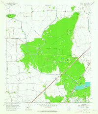
1962 Map of Fannett West
USGS Topo · Published 1964About this map
Lawhorn Woods dominates the center of this coastal prairie landscape, illustrating the intricate drainage network of Southeast Texas in the early 1960s. The area is defined by the convergence of the North Fork Taylor Bayou and South Fork Taylor Bayou, which feed into the larger Taylor Bayou. This watery terrain is further characterized by numerous gullies, including Pignut Gully, Pond Gully, and Vogel Gully.
Find a feature on this map
34 named features on this map. Tap any name to fly to it.
Don’t see what you’re looking for? This feature index may not catch every label — zoom into the map to look around manually.
Map Details
Editions of this 1962 Fannett West Map
2 editions found

Other maps of this area

1932 · Beaumont
USGS Topo · 1:62,500

1943 · Stowell
USGS Topo · 1:24,000

1943 · Fannett East
USGS Topo · 1:24,000

1945 · Fannett East
USGS Topo · 1:31,680

1945 · Nolte
USGS Topo · 1:31,680

1950 · Houston
USGS Topo · 1:250,000

1954 · Beaumont
USGS Topo · 1:250,000

1955 · Sour Lake
USGS Topo · 1:62,500

1956 · Houston
USGS Topo · 1:250,000

1957 · Beaumont
USGS Topo · 1:250,000