
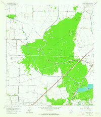
1962 Map of Fannett West
USGS Topo · Published 1978About this map
The low-lying coastal prairie of Jefferson County and Chambers County is defined here by the intricate drainage of the North Fork Taylor Bayou and its southern counterpart. The landscape is a mix of dense forest such as Lawhorn Woods and industrial development, characterized by the extensive extraction infrastructure of the Gilbert Ranch Oil Field and the Marrs McLean Gas Field. These energy interests are supported by a network of pipelines and service roads that crisscross the wetlands.
Find a feature on this map
34 named features on this map. Tap any name to fly to it.
Don’t see what you’re looking for? This feature index may not catch every label — zoom into the map to look around manually.
Map Details
Editions of this 1962 Fannett West Map
2 editions found
Other maps of this area

1932 · Beaumont
USGS Topo · 1:62,500

1943 · Stowell
USGS Topo · 1:24,000

1943 · Fannett East
USGS Topo · 1:24,000

1945 · Fannett East
USGS Topo · 1:31,680

1945 · Nolte
USGS Topo · 1:31,680

1950 · Houston
USGS Topo · 1:250,000

1954 · Beaumont
USGS Topo · 1:250,000

1955 · Sour Lake
USGS Topo · 1:62,500

1956 · Houston
USGS Topo · 1:250,000

1957 · Beaumont
USGS Topo · 1:250,000