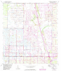
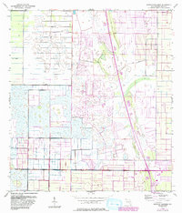
1953 Map of Fellsmere 4 NE
USGS Topo · Published 1983About this map
Vero Lake Estates stands out as the primary residential development within this landscape of drainage management in Indian River County. The map details an environment defined by human engineering, characterized by extensive Levee systems and numerous Spoil Banks that illustrate the transformation of Florida's wetlands for agriculture and settlement during the mid-20th century. Based on 1953 surveys with revisions updated into the early 1980s, the cartography reflects a period of significant hydraulic modification. The grid-like patterns of canals and embankments reveal the intensive effort to control water flow, creating a distinct geometry across the terrain that contrasts with the developing suburban footprint of the estates to the north.
Find a feature on this map
5 named features on this map. Tap any name to fly to it.
Don’t see what you’re looking for? This feature index may not catch every label — zoom into the map to look around manually.
Map Details
Editions of this 1953 Fellsmere 4 NE Map
5 editions found
Other maps of this area

1949 · Fellsmere
USGS Topo · 1:24,000

1949 · Vero Beach
USGS Topo · 1:24,000

1949 · Sebastian
USGS Topo · 1:24,000

1949 · Oslo
USGS Topo · 1:24,000

1950 · Oslo
USGS Topo · 1:24,000

1950 · Vero Beach
USGS Topo · 1:24,000

1951 · Fellsmere
USGS Topo · 1:24,000

1951 · Sebastian
USGS Topo · 1:24,000

1953 · Fellsmere SW
USGS Topo · 1:24,000

1953 · Fellsmere 4 SE
USGS Topo · 1:24,000