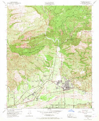
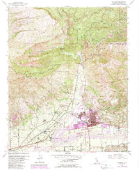
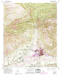
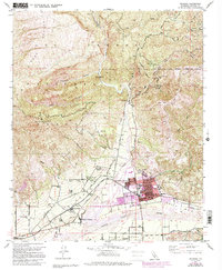
1951 Map of Fillmore
USGS Topo · Published 1968About this map
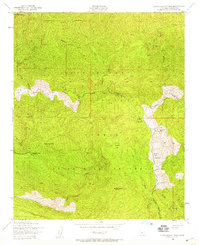
Fillmore and its citrus-growing surroundings appear here at mid-century, defined by the convergence of the Santa Clara River and Sespe Creek. The town's layout is meticulously detailed, showing the industrial influence of the Southern Pacific railroad and the Union HS campus. Beyond the residential grid, the landscape is a patchwork of orchards and infrastructure, including the Brownstone Reservoir and several pumping stations. Smaller settlements such as North Fillmore, Bardsdale, and Sespe Village dot the valley floor, while the northern reaches transition into the protected lands of the Sespe National Wildlife Refuge. The map provides specific locations for early community landmarks like the Santa Clara Sch and Kenney Grove, alongside the petroleum development marked by numerous oil wells and tanks in the foothills.
Find a feature on this map
59 named features on this map. Tap any name to fly to it.
Don’t see what you’re looking for? This feature index may not catch every label — zoom into the map to look around manually.
Map Details
Editions of this 1951 Fillmore Map
7 editions found
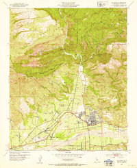
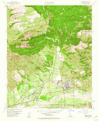
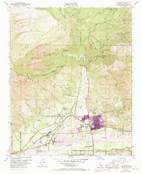
Other maps of this area

1900 · Piru
USGS Topo · 1:62,500

1903 · Santa Paula
USGS Topo · 1:62,500

1903 · Mt. Pinos
USGS Topo · 1:125,000

1903 · Tejon
USGS Topo · 1:125,000

1903 · Camulos
USGS Topo · 1:125,000

1921 · Piru
USGS Topo · 1:62,500

1941 · Piru
USGS Topo · 1:62,500

1942 · Santa Paula
USGS Topo · 1:62,500
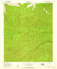
1943 · Topatopa Mountains
USGS Topo · 1:24,000
1943 · Devils Heart Peak
USGS Topo · 1:24,000