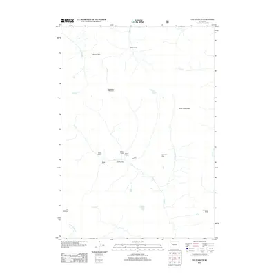
2012 Map of Five Pockets
USGS Topo · Published 2012About this map
Five Pockets characterizes this high-elevation wilderness in Wyoming, where several distinct natural depressions—including West Pocket, South Pocket, and Bear Pocket—cluster along the upper reaches of Horse Cr. The area is defined by sharp vertical relief and complex drainage patterns, with water moving from the high slopes of Raggedtop Mountain and Cathedral Peak toward the south and west. Significant landmarks such as The Ramshorn and the geological formation at Havely Rock Garden dominate the northern and central terrain. This 2012 survey illustrates a landscape primarily shaped by its hydrology, where Twilight Falls and several alpine lakes, like Eloise Lake and Deacon Lake, sit tucked between mountain passes and ridgelines. The absence of roads or permanent structures reflects the protected and primitive state of these drainages within the larger forest system.
Find a feature on this map
25 named features on this map. Tap any name to fly to it.
Don’t see what you’re looking for? This feature index may not catch every label — zoom into the map to look around manually.
Map Details
Editions of this 2012 Five Pockets Map
This is the sole edition of this map. No revisions or reprints were ever made.
Other maps of this area

1905 · Younts Peak
USGS Topo · 1:125,000

1907 · Younts Peak
USGS Topo · 1:125,000

1955 · Thermopolis
USGS Topo · 1:250,000

1956 · Indian Point
USGS Topo · 1:24,000

1956 · Esmond Park
USGS Topo · 1:24,000

1956 · Shoshone Pass
USGS Topo · 1:24,000

1956 · Ramshorn Peak
USGS Topo · 1:24,000

1956 · Snow Lake
USGS Topo · 1:24,000

1956 · Five Pockets
USGS Topo · 1:24,000

1956 · Emerald Lake
USGS Topo · 1:24,000