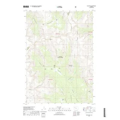
2017 Map of Five Pockets
USGS Topo · Published 2017About this map
Shoshone National Forest encompasses this high-altitude landscape along the border of Park and Fremont Counties. The area is defined by the sharp elevations of the Absaroka Range, where notable summits like Raggedtop Mtn, Cathedral Peak, and the distinctive The Ramshorn dominate the horizon. A complex network of drainage basins and high pockets, including the namesake Five Pockets, West Pocket, and Bear Pocket, creates a secluded topography accessible primarily through historical pack trails.
Find a feature on this map
31 named features on this map. Tap any name to fly to it.
Don’t see what you’re looking for? This feature index may not catch every label — zoom into the map to look around manually.
Map Details
Editions of this 2017 Five Pockets Map
This is the sole edition of this map. No revisions or reprints were ever made.
Other maps of this area

1905 · Younts Peak
USGS Topo · 1:125,000

1907 · Younts Peak
USGS Topo · 1:125,000

1955 · Thermopolis
USGS Topo · 1:250,000

1956 · Indian Point
USGS Topo · 1:24,000

1956 · Esmond Park
USGS Topo · 1:24,000

1956 · Shoshone Pass
USGS Topo · 1:24,000

1956 · Ramshorn Peak
USGS Topo · 1:24,000

1956 · Snow Lake
USGS Topo · 1:24,000

1956 · Five Pockets
USGS Topo · 1:24,000

1956 · Emerald Lake
USGS Topo · 1:24,000