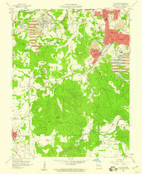
1958 Map of Flat River
USGS Topo · Published 1959About this map
Lead mining operations dominate the landscape of the eastern Ozarks in this late 1950s survey, where massive tailings piles and mine dumps surround established company towns. The industrial footprint of the Old Lead Belt is evident in the dense cluster of settlements like Leadwood, Desloge, Elvins, and Flat River, all connected by the Missouri Illinois railroad. Deep mine shafts such as Hunt Mine and Baker Mine signify the subterranean activity that drove the regional economy, while the surface is marked by extensive waste deposits that redirected local drainage patterns.
Find a feature on this map
52 named features on this map. Tap any name to fly to it.
Don’t see what you’re looking for? This feature index may not catch every label — zoom into the map to look around manually.
Map Details
Editions of this 1958 Flat River Map
4 editions found
Other maps of this area

1904 · Farmington
USGS Topo · 1:62,500

1905 · Bonneterre
USGS Topo · 1:62,500

1906 · Farmington
USGS Topo · 1:62,500

1937 · Ironton
USGS Topo · 1:48,000

1939 · Fredericktown
USGS Topo · 1:48,000

1945 · Ironton
USGS Topo · 1:62,500

1946 · Ironton
USGS Topo · 1:62,500

1947 · Fredericktown
USGS Topo · 1:62,500

1949 · Rolla
USGS Topo · 1:250,000

1950 · Fredericktown
USGS Topo · 1:62,500