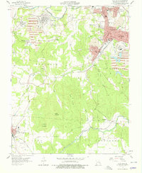
1958 Map of Flat River
USGS Topo · Published 1979About this map
Lead mining operations and heavy industrial activity define the landscape around Flat River and Desloge in the late 1950s. The region is marked by extensive tailing piles and numerous Mine Dumps, most notably near Leadwood and Rivermines, reflecting the area's economic dependence on mineral extraction. The urban corridor stretching from Esther through Elvins shows a dense concentration of residential development, including educational facilities like the Jr College and Eugene Field Sch.
Find a feature on this map
49 named features on this map. Tap any name to fly to it.
Don’t see what you’re looking for? This feature index may not catch every label — zoom into the map to look around manually.
Map Details
Editions of this 1958 Flat River Map
4 editions found
Other maps of this area

1904 · Farmington
USGS Topo · 1:62,500

1905 · Bonneterre
USGS Topo · 1:62,500

1906 · Farmington
USGS Topo · 1:62,500

1937 · Ironton
USGS Topo · 1:48,000

1939 · Fredericktown
USGS Topo · 1:48,000

1945 · Ironton
USGS Topo · 1:62,500

1946 · Ironton
USGS Topo · 1:62,500

1947 · Fredericktown
USGS Topo · 1:62,500

1949 · Rolla
USGS Topo · 1:250,000

1950 · Fredericktown
USGS Topo · 1:62,500