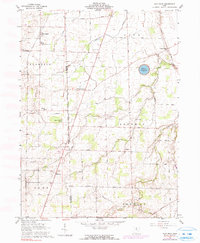
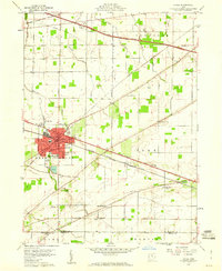
1960 Map of Flat Rock
USGS Topo · Published 1990About this map
The West Boundary of Congress Lands defines the central axis of this landscape, marking the historic intersection of the Seneca and Huron County line. This 1960 era survey reveals a rural landscape deeply rooted in religious and social tradition, anchored by the Sorrowfull Mother Shrine and several country churches like St Pauls Ch. Small agricultural hamlets such as Bismarck and Reedtown dot the crossroads, while the Norfolk and Western railroad cuts a diagonal path through Flat Rock and Omar. Geologic and infrastructural features are prominent, from the subterranean Seneca Caverns to the engineered Bellevue Reservoir in the northeast. The map also meticulously records several local burial grounds, including St Michaels Cem and the Township Cem, providing a detailed record of the area's pioneer and community genealogy.
Find a feature on this map
52 named features on this map. Tap any name to fly to it.
Don’t see what you’re looking for? This feature index may not catch every label — zoom into the map to look around manually.
Map Details
Editions of this 1960 Flat Rock Map
3 editions found
Other maps of this area

1901 · Bellevue
USGS Topo · 1:62,500

1903 · Bellevue
USGS Topo · 1:62,500

1904 · Sandusky
USGS Topo · 1:62,500

1915 · Norwalk
USGS Topo · 1:62,500

1915 · Siam
USGS Topo · 1:62,500

1944 · Norwalk
USGS Topo · 1:62,500

1956 · Toledo
USGS Topo · 1:250,000

1959 · Kimball
USGS Topo · 1:24,000
1959 · Bellevue
USGS Topo · 1:24,000
1959 · Clyde
USGS Topo · 1:24,000