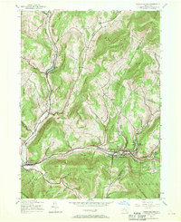
1945 Map of Fleischmanns
USGS Topo · Published 1970About this map
Fleischmanns and Arkville serve as the primary hubs in this high-elevation pocket of the Catskills, where the New York Central rail line follows the winding course of the Bush Kill and the East Branch Delaware River. The map reveals a landscape defined by steep ridges like Hog Mountain and Fleischmann Mountain, where human settlement is strictly confined to the narrow hollows and valley floors. Genealogists will find several burial sites including Arkville Cem and Scudder Cem, while the location of Denver Sch and various numbered schoolhouses, such as School No 14 near Bedell, provide a clear picture of the rural educational network of the mid-1940s. The northern reaches of Catskill Park encompass much of the southern terrain, with specialized landmarks like Mine Hollow and the waters of Lake Switzerland offering specific points of interest for local history researchers.
Find a feature on this map
52 named features on this map. Tap any name to fly to it.
Don’t see what you’re looking for? This feature index may not catch every label — zoom into the map to look around manually.
Map Details
Editions of this 1945 Fleischmanns Map
4 editions found
Other maps of this area

1900 · Phoenicia
USGS Topo · 1:62,500

1901 · Margaretville
USGS Topo · 1:62,500

1901 · Gilboa
USGS Topo · 1:62,500

1903 · Gilboa
USGS Topo · 1:62,500

1903 · Phoenicia
USGS Topo · 1:62,500

1904 · Hobart
USGS Topo · 1:62,500

1904 · Margaretville
USGS Topo · 1:62,500
1945 · Seager
USGS Topo · 1:24,000

1945 · West Kill
USGS Topo · 1:24,000

1945 · Fleischmanns
USGS Topo · 1:24,000