
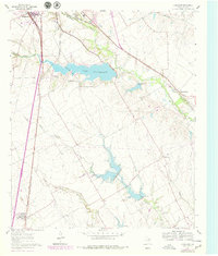
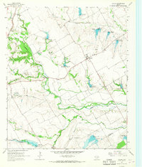
1961 Map of Forreston
USGS Topo · Published 1963About this map
Lake Waxahachie dominates the central landscape of this Ellis County survey, its irregular shoreline reaching into the surrounding Texas blackland prairies. The reservoir is fed by South Prong Creek and Waxahachie Creek, serving as a focal point for the growing water needs of Waxahachie at the start of the 1960s. The mapping shows a transition from agricultural use to infrastructure, evidenced by the numerous Gravel Pits and the Filtration Plant near the lake's edge.
Find a feature on this map
24 named features on this map. Tap any name to fly to it.
Don’t see what you’re looking for? This feature index may not catch every label — zoom into the map to look around manually.
Map Details
Editions of this 1961 Forreston Map
2 editions found
Other maps of this area

1954 · Dallas
USGS Topo · 1:250,000

1956 · Ennis
USGS Topo · 1:62,500

1958 · Dallas
USGS Topo · 1:250,000

1960 · Boz
USGS Topo · 1:24,000
1961 · Midlothian
USGS Topo · 1:24,000
1961 · Waxahachie
USGS Topo · 1:24,000

1962 · Ennis West
USGS Topo · 1:24,000

1962 · Cryer Creek
USGS Topo · 1:24,000
1963 · Palmer
USGS Topo · 1:24,000
1965 · Avalon
USGS Topo · 1:24,000