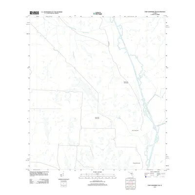
2012 Map of Fort Kissimmee NW
USGS Topo · Published 2012About this map
The Kissimmee River meanders along the eastern edge of this Central Florida landscape, defining a terrain shaped by intricate drainage patterns and isolated higher ground. Local nomenclature reflects the character of the wet prairies and marshlands, with features like Ice Cream Slough, Eightmile Slough, and Tick Island Slough cutting through the low-lying reaches. These watercourses are punctuated by hardwood hammocks—islands of dense vegetation including Rattlesnake Hammock, Hard Luck Hammock, and Orange Hammock—which historically provided crucial dry ground for cattle ranching and early settlement. The presence of Appaloosa Trl and various unnamed tracks suggests the continued agricultural and recreational use of this interior region, where Gum Br feeds into the wider river system.
Find a feature on this map
10 named features on this map. Tap any name to fly to it.
Don’t see what you’re looking for? This feature index may not catch every label — zoom into the map to look around manually.
Map Details
Editions of this 2012 Fort Kissimmee NW Map
This is the sole edition of this map. No revisions or reprints were ever made.
Other maps of this area

1952 · Fort Kissimmee
USGS Topo · 1:24,000

1952 · Lake Weohyakapka SE
USGS Topo · 1:24,000

1952 · Fort Kissimmee NW
USGS Topo · 1:24,000

1952 · Lake Arbuckle NE
USGS Topo · 1:24,000

1952 · Lake Arbuckle SE
USGS Topo · 1:24,000

1953 · Fort Kissimmee NE
USGS Topo · 1:24,000

1953 · Lake Marian SE
USGS Topo · 1:24,000

1953 · Lake Marian SW
USGS Topo · 1:24,000

1953 · Fort Kissimmee SE
USGS Topo · 1:24,000

1956 · Fort Pierce
USGS Topo · 1:250,000