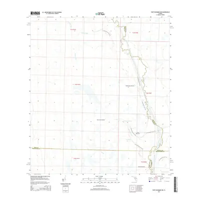
2015 Map of Fort Kissimmee NW
USGS Topo · Published 2015About this map
The Kissimmee River meanders along the eastern boundary of this central Florida landscape, marking a complex hydrologic network at the junction of Polk, Osceola, Highlands, and Okeechobee counties. This 2015 survey reveals an environment defined by seasonal wetlands and elevated hammocks, including Rattlesnake Hammock, Hard Luck Hammock, and Orange Hammock. The drainage patterns are meticulously documented through a series of named sloughs such as Ice Cream Slough, Eightmile Slough, and Tick Island Slough.
Find a feature on this map
21 named features on this map. Tap any name to fly to it.
Don’t see what you’re looking for? This feature index may not catch every label — zoom into the map to look around manually.
Map Details
Editions of this 2015 Fort Kissimmee NW Map
This is the sole edition of this map. No revisions or reprints were ever made.
Other maps of this area

1952 · Fort Kissimmee
USGS Topo · 1:24,000

1952 · Lake Weohyakapka SE
USGS Topo · 1:24,000

1952 · Fort Kissimmee NW
USGS Topo · 1:24,000

1952 · Lake Arbuckle NE
USGS Topo · 1:24,000

1952 · Lake Arbuckle SE
USGS Topo · 1:24,000

1953 · Fort Kissimmee NE
USGS Topo · 1:24,000

1953 · Lake Marian SE
USGS Topo · 1:24,000

1953 · Lake Marian SW
USGS Topo · 1:24,000

1953 · Fort Kissimmee SE
USGS Topo · 1:24,000

1956 · Fort Pierce
USGS Topo · 1:250,000