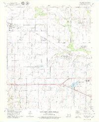
1979 Map of Fort Reno
USGS Topo · Published 1979About this map
Fort Reno serves as a focal point in this late 1970s survey of the Canadian County landscape, where military history and agricultural research intersect. The map documents the extensive grounds of the Southwestern Livestock and Forage Research Sta and the nearby Fort Reno Post Cem, reflecting the area's transition from a frontier military post to a center for scientific study. To the west, the town of Calumet sits along the Chicago Rock Island and Pacific railroad, which cuts a straight path across the plains.
Find a feature on this map
26 named features on this map. Tap any name to fly to it.
Don’t see what you’re looking for? This feature index may not catch every label — zoom into the map to look around manually.
Map Details
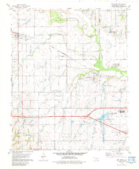
Editions of this 1979 Fort Reno Map
2 editions found
Other maps of this area

1892 · Kingfisher
USGS Topo · 1:125,000

1893 · Fort Reno
USGS Topo · 1:62,500

1893 · Buggy Creek
USGS Topo · 1:62,500

1893 · Minco
USGS Topo · 1:62,500

1895 · Kingfisher
USGS Topo · 1:125,000

1904 · Chickasha
USGS Topo · 1:125,000

1941 · Fort Reno
USGS Topo · 1:62,500

1942 · Fort Reno
USGS Topo · 1:62,500

1949 · Fort Reno
USGS Topo · 1:62,500

1954 · Oklahoma City
USGS Topo · 1:250,000