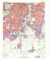
1955 Map of Fort Worth
USGS Topo · Published 1969About this map
The confluence of the Trinity River and the Clear Fork Trinity River anchors this 1955 survey of Fort Worth, Texas, captured just as the city began its post-war suburban expansion. Institutional growth is a primary theme, with the sprawling campuses of Texas Christian University and the Southwestern Baptist Theological Seminary clearly delineated. The map highlights the city's complex rail infrastructure, showing lines like the St Louis Southwestern RR and Missouri Kansas Texas RR serving the Fort Worth General Depot.
Find a feature on this map
114 named features on this map. Tap any name to fly to it.
Don’t see what you’re looking for? This feature index may not catch every label — zoom into the map to look around manually.
Map Details
Editions of this 1955 Fort Worth Map
5 editions found

Other maps of this area

1894 · Fort Worth
USGS Topo · 1:125,000

1931 · Grapevine
USGS Topo · 1:62,500

1954 · Dallas
USGS Topo · 1:250,000

1955 · Haltom City
USGS Topo · 1:24,000

1955 · Burleson
USGS Topo · 1:24,000

1955 · Primrose
USGS Topo · 1:24,000

1955 · Lake Worth
USGS Topo · 1:24,000

1955 · Benbrook
USGS Topo · 1:24,000

1955 · Fort Worth
USGS Topo · 1:24,000

1955 · Haltom City
USGS Topo · 1:62,500