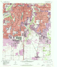
1955 Map of Fort Worth
USGS Topo · Published 1974About this map
The Trinity River and its Clear Fork anchor the northwestern corner of this urban landscape, where the Botanical Gardens and Will Rogers Memorial mark the city's cultural development. Education and healthcare are central themes of the mid-century city, with the expansive campus of Texas Christian University and the Southwestern Baptist Theological Seminary situated alongside specialized institutions like the Masonic Home and School and the US Public Health Service Hospital. To the south, the Fort Worth General Depot highlights the area's strategic logistical role during the era.
Find a feature on this map
98 named features on this map. Tap any name to fly to it.
Don’t see what you’re looking for? This feature index may not catch every label — zoom into the map to look around manually.
Map Details
Editions of this 1955 Fort Worth Map
5 editions found

Other maps of this area

1894 · Fort Worth
USGS Topo · 1:125,000

1931 · Grapevine
USGS Topo · 1:62,500

1954 · Dallas
USGS Topo · 1:250,000

1955 · Haltom City
USGS Topo · 1:24,000

1955 · Burleson
USGS Topo · 1:24,000

1955 · Primrose
USGS Topo · 1:24,000

1955 · Lake Worth
USGS Topo · 1:24,000

1955 · Benbrook
USGS Topo · 1:24,000

1955 · Fort Worth
USGS Topo · 1:24,000

1955 · Haltom City
USGS Topo · 1:62,500