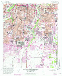
1955 Map of Fort Worth
USGS Topo · Published 1982About this map
The Trinity River and its Clear Fork wind through the heart of Fort Worth, anchoring a landscape of established neighborhoods, industrial corridors, and educational institutions. This 1950s survey, updated in the early 1980s, highlights the sprawling academic and spiritual presence of the Southwestern Baptist Theological Seminary and the Tarrant County Junior College South Campus. The southern reaches of the city give way to more open land around Everman and the Sycamore Strip Airport. Cultural landmarks like the Botanical Gardens and Will Rogers Memorial are set against the practical infrastructure of the Missouri Pacific railroad and the Dallas-Ft Worth Turnpike. To the southeast, the Federal Correctional Institution and Masonic Home and School stand as significant institutional footprints within the Tarrant County terrain.
Find a feature on this map
74 named features on this map. Tap any name to fly to it.
Don’t see what you’re looking for? This feature index may not catch every label — zoom into the map to look around manually.
Map Details
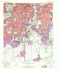
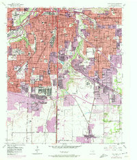
Editions of this 1955 Fort Worth Map
5 editions found

Other maps of this area

1894 · Fort Worth
USGS Topo · 1:125,000

1931 · Grapevine
USGS Topo · 1:62,500

1954 · Dallas
USGS Topo · 1:250,000

1955 · Haltom City
USGS Topo · 1:24,000

1955 · Burleson
USGS Topo · 1:24,000

1955 · Primrose
USGS Topo · 1:24,000

1955 · Lake Worth
USGS Topo · 1:24,000

1955 · Benbrook
USGS Topo · 1:24,000

1955 · Fort Worth
USGS Topo · 1:24,000

1955 · Haltom City
USGS Topo · 1:62,500