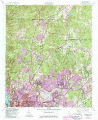
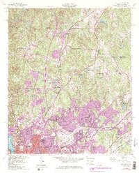
1955 Map of Fortson
USGS Topo · Published 1986About this map
Columbus serves as the focal point for this mid-century survey of the Georgia-Alabama borderlands, where the Chattahoochee River carves a deep boundary between Muscogee County and Alabama. To the north, the small settlement of Fortson sits along the Southern railroad line, surrounded by a network of family-named landmarks and rural congregations like Pierce Chapel Church and Mount Gilead Church. The landscape transitions from the developed streets of Bibb City and Caroline Park to the expansive drainage basins of Bull Creek and Heiferhorn Creek.
Find a feature on this map
65 named features on this map. Tap any name to fly to it.
Don’t see what you’re looking for? This feature index may not catch every label — zoom into the map to look around manually.
Map Details
Editions of this 1955 Fortson Map
5 editions found
Other maps of this area

1907 · Talbotton
USGS Topo · 1:125,000

1907 · Opelika
USGS Topo · 1:125,000

1908 · Columbus
USGS Topo · 1:62,500

1909 · Opelika
USGS Topo · 1:125,000

1914 · Seale
USGS Topo · 1:62,500

1929 · Columbus
USGS Topo · 1:48,000

1947 · Columbus
USGS Topo · 1:62,500

1949 · Midland
USGS Topo · 1:24,000

1949 · Ochillee
USGS Topo · 1:24,000

1949 · Columbus
USGS Topo · 1:24,000