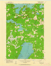
1953 Map of Fredenberg
USGS Topo · Published 1962About this map
The Wild Rice Lake Reservoir and Island Lake Reservoir dominate this 1950s landscape north of Duluth, where the hydrologic management of the St. Louis River watershed is clearly visible. The small settlement of Fredenberg serves as a central point in a region characterized by a network of large reservoirs and smaller natural bodies like Fredenberg Lake and Schultz Lake. The map reveals the transitional nature of the local economy and infrastructure, featuring a Railroad Grade and a Gravel Pit, alongside evidence of fire protection and community life such as the Mirror Lake Lookout Tower and St Joseph Ch. The jagged shorelines of the Fish Lake Reservoir highlight the complex topography of the Fredenberg and Gnesen townships during a period when these waters were critical for both local power and regional utility.
Find a feature on this map
20 named features on this map. Tap any name to fly to it.
Don’t see what you’re looking for? This feature index may not catch every label — zoom into the map to look around manually.
Map Details
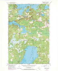
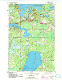
Editions of this 1953 Fredenberg Map
4 editions found
Other maps of this area

1895 · Duluth
USGS Topo · 1:62,500

1953 · Twig
USGS Topo · 1:24,000

1953 · Shaw
USGS Topo · 1:24,000

1953 · Adolph
USGS Topo · 1:24,000

1953 · Arnold
USGS Topo · 1:24,000

1953 · Duluth
USGS Topo · 1:24,000

1953 · Duluth Heights
USGS Topo · 1:24,000

1953 · Boulder Lake Reservoir
USGS Topo · 1:24,000

1953 · Fredenberg
USGS Topo · 1:24,000

1953 · Duluth
USGS Topo · 1:62,500