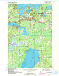
1953 Map of Fredenberg
USGS Topo · Published 1993About this map
The small settlement of Fredenberg serves as a quiet center point for this lake-heavy portion of St. Louis County, Minnesota. Surveyed in the early 1950s with later 1990s revisions, the landscape is defined by extensive water management systems, including the Island Lake Reservoir, Fish Lake Reservoir, and Wild Rice Lake Reservoir. These reservoirs, managed at specific pool elevations, are interspersed with smaller natural bodies of water like Deepwater Lake, Clearwater Lake, and Schultz Lake. Conservation and recreation areas are prominent, particularly the Canosia State Wildlife Management Area in the southwest. Cultural landmarks include St Joseph Ch and a series of Gravel Pits, indicating local resource extraction. The road network connects these remote lakeside communities via routes like Cloquet, while the Beaver River winds through the wetlands, illustrating the region's complex hydrology.
Find a feature on this map
22 named features on this map. Tap any name to fly to it.
Don’t see what you’re looking for? This feature index may not catch every label — zoom into the map to look around manually.
Map Details
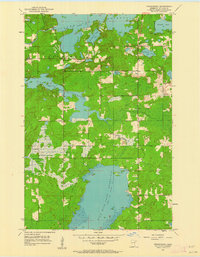
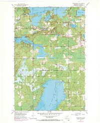
Editions of this 1953 Fredenberg Map
4 editions found
Other maps of this area

1895 · Duluth
USGS Topo · 1:62,500

1953 · Twig
USGS Topo · 1:24,000

1953 · Shaw
USGS Topo · 1:24,000

1953 · Adolph
USGS Topo · 1:24,000

1953 · Arnold
USGS Topo · 1:24,000

1953 · Duluth
USGS Topo · 1:24,000

1953 · Duluth Heights
USGS Topo · 1:24,000

1953 · Boulder Lake Reservoir
USGS Topo · 1:24,000

1953 · Fredenberg
USGS Topo · 1:24,000

1953 · Duluth
USGS Topo · 1:62,500