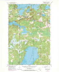
1953 Map of Fredenberg
USGS Topo · Published 1970About this map
Island Lake Reservoir and the surrounding Northwoods dominate this St. Louis County landscape during the mid-20th century. The settlement of Fredenberg serves as a small hub amidst a complex network of glacial lakes and reservoirs, including Fish Lake Reservoir and Wild Rice Lake Reservoir. These water bodies, managed for conservation and power, define the local geography alongside natural features like Rice Lake and the winding Beaver River.
Find a feature on this map
20 named features on this map. Tap any name to fly to it.
Don’t see what you’re looking for? This feature index may not catch every label — zoom into the map to look around manually.
Map Details
Editions of this 1953 Fredenberg Map
4 editions found
Other maps of this area

1895 · Duluth
USGS Topo · 1:62,500

1953 · Twig
USGS Topo · 1:24,000

1953 · Shaw
USGS Topo · 1:24,000

1953 · Adolph
USGS Topo · 1:24,000

1953 · Arnold
USGS Topo · 1:24,000

1953 · Duluth
USGS Topo · 1:24,000

1953 · Duluth Heights
USGS Topo · 1:24,000

1953 · Boulder Lake Reservoir
USGS Topo · 1:24,000

1953 · Fredenberg
USGS Topo · 1:24,000

1953 · Duluth
USGS Topo · 1:62,500