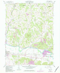
1961 Map of Fresno
USGS Topo · Published 1984About this map
Tuscarawas River flows through the southern half of this mid-century landscape, dividing the northern uplands of Progressive Valley from the wide agricultural expanse known as The Plains. The rail corridors of the Conrail and Norfolk And Western define the valley floor, connecting industrial and transit points like West Lafayette and Pearl (Chili Sta). The map reveals an intensive era of resource extraction, with numerous strip mines dotting the ridges near Hothem Ridge and Chestnut Ridge, while gravel pits cluster near Isleta. Genealogists will find a wealth of family-named landmarks, including the Woods College Cem, Waggoner Cem, and Ferguson Cem. Local community life is anchored by landmarks such as the Grange Hall and the Tri-City Airpark, while the river bends near Shady Bend illustrate the natural hydrology before modern developments altered the floodplains.
Find a feature on this map
63 named features on this map. Tap any name to fly to it.
Don’t see what you’re looking for? This feature index may not catch every label — zoom into the map to look around manually.
Map Details
Editions of this 1961 Fresno Map
4 editions found
Other maps of this area

1908 · Conesville
USGS Topo · 1:62,500

1909 · Cambridge
USGS Topo · 1:62,500

1910 · Conesville
USGS Topo · 1:62,500

1911 · Newcomerstown
USGS Topo · 1:62,500

1912 · Cambridge
USGS Topo · 1:62,500

1913 · Newcomerstown
USGS Topo · 1:62,500

1913 · Coshocton
USGS Topo · 1:62,500

1915 · Coshocton
USGS Topo · 1:62,500

1943 · Coshocton
USGS Topo · 1:62,500

1943 · Newcomerstown
USGS Topo · 1:62,500