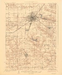
1927 Map of Galesburg
USGS Topo · Published 1927About this map
The dense rail infrastructure of central Knox County is on full display here during the 1920s, showing the convergences of the Chicago Burlington And Quincy and the Atchison Topeka And Santa Fe at the regional hub of Galesburg. This era reveals a landscape transition from the tightly gridded urban center, featuring landmarks like Lincoln Park and Rice Lake, to a periphery dotted with dozens of small district schools. Local genealogists will find an incredible density of educational sites, from Cherry Farm School to the uniquely named Tie-Plant School. To the south, the development of leisure spaces is evident near Saluda at Lake Bracken and the Knox County Country Club. Smaller settlements like East Galesburg Randall PO, Abingdon, and Knoxville maintain their own distinct footprints, while rural life is anchored by landmarks such as Orange Chapel and Haynes Church.
Find a feature on this map
83 named features on this map. Tap any name to fly to it.
Don’t see what you’re looking for? This feature index may not catch every label — zoom into the map to look around manually.
Map Details
Editions of this 1927 Galesburg Map
3 editions found
Other maps of this area

1912 · Canton
USGS Topo · 1:62,500

1915 · Avon
USGS Topo · 1:62,500

1916 · Good Hope
USGS Topo · 1:62,500

1918 · Good Hope
USGS Topo · 1:62,500

1921 · Monmouth
USGS Topo · 1:62,500

1923 · Monmouth
USGS Topo · 1:62,500

1923 · Alexis
USGS Topo · 1:62,500

1925 · Alexis
USGS Topo · 1:62,500

1925 · Galesburg
USGS Topo · 1:62,500

1927 · Galesburg
USGS Topo · 1:62,500