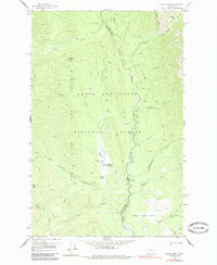
1958 Map of Gates Park
USGS Topo · Published 1985About this map
The North Fork Sun River carves a deep valley through this backcountry corridor of the Lewis and Clark National Forest in the late 1950s. Far from any modern highway, the landscape is defined by an extensive network of foot and horse paths, including a primary Pack Trail that follows Lick Creek and Gates Creek through the mountains. This area serves as a vital administrative and survival hub within the Lewis and Clark Game Preserve, anchored by the Gates Park Guard Station and a nearby private landing strip used for mountain access. The terrain transitions from the high peaks of Wapiti Ridge and Goat Ridge down to open spaces like Ninemile Park and Biggs Flat, illustrating the remote management of Montana's wilderness before the onset of modern development.
Find a feature on this map
34 named features on this map. Tap any name to fly to it.
Don’t see what you’re looking for? This feature index may not catch every label — zoom into the map to look around manually.
Map Details
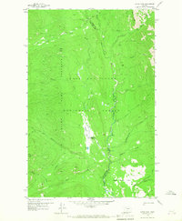
Editions of this 1958 Gates Park Map
3 editions found

Other maps of this area

1903 · Saypo
USGS Topo · 1:125,000

1936 · Silvertip
USGS Topo · 1:96,000

1942 · Silvertip
USGS Topo · 1:125,000

1955 · Choteau
USGS Topo · 1:250,000

1957 · Choteau
USGS Topo · 1:250,000

1958 · Choteau
USGS Topo · 1:250,000

1958 · Porphyry Reef
USGS Topo · 1:24,000

1958 · Mount Wright
USGS Topo · 1:24,000

1958 · Our Lake
USGS Topo · 1:24,000

1958 · Glenn Creek
USGS Topo · 1:24,000