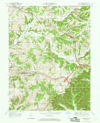
1966 Map of Georgetown
USGS Topo · Published 1969About this map
Georgetown and Edwardsville sit at the center of this Floyd County landscape, where the Southern railroad winds through the hills of southern Indiana. The topography is defined by a series of prominent ridges to the south, including Pear Ridge, Musty Ridge, and Hickory Ridge, which separate deep hollows and creek beds. These physical barriers influenced the early road network, visible in the winding paths of the Old Indian Road and Corydon Road.
Find a feature on this map
60 named features on this map. Tap any name to fly to it.
Don’t see what you’re looking for? This feature index may not catch every label — zoom into the map to look around manually.
Map Details
Editions of this 1966 Georgetown Map
4 editions found
Other maps of this area

1909 · Kosmosdale
USGS Topo · 1:48,000

1912 · Kosmosdale
USGS Topo · 1:62,500

1931 · Corydon
USGS Topo · 1:62,500

1938 · Speed
USGS Topo · 1:24,000

1939 · New Albany
USGS Topo · 1:24,000

1939 · Georgetown
USGS Topo · 1:24,000

1941 · Borden
USGS Topo · 1:24,000

1946 · New Albany
USGS Topo · 1:24,000

1947 · Speed
USGS Topo · 1:24,000

1947 · Georgetown
USGS Topo · 1:24,000