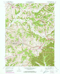
1966 Map of Georgetown
USGS Topo · Published 1981About this map
Georgetown and Greenville serve as the primary hubs in this portion of Floyd County, where the southern Indiana landscape is defined by the winding course of Middle Fork Indian Creek and Little Indian Creek. The topography is marked by a series of prominent ridges to the south, including Pear Ridge and Skipsey Ridge, which create deep hollows like Bell Hollow. The influence of the Southern railroad is evident as it cuts through the center of the sheet, passing by a Drive-in Theater near Georgetown and heading toward Edwardsville. Local heritage is anchored by longstanding institutions such as the Mt St Francis Seminary, the Greenville Christian Ch, and the Galena Sch. This 1966 survey, later updated in 1980, captures the transition of a rural landscape as modern transportation corridors began to parallel older routes like Old Indian Road.
Find a feature on this map
52 named features on this map. Tap any name to fly to it.
Don’t see what you’re looking for? This feature index may not catch every label — zoom into the map to look around manually.
Map Details
Editions of this 1966 Georgetown Map
4 editions found
Other maps of this area

1909 · Kosmosdale
USGS Topo · 1:48,000

1912 · Kosmosdale
USGS Topo · 1:62,500

1931 · Corydon
USGS Topo · 1:62,500

1938 · Speed
USGS Topo · 1:24,000

1939 · New Albany
USGS Topo · 1:24,000

1939 · Georgetown
USGS Topo · 1:24,000

1941 · Borden
USGS Topo · 1:24,000

1946 · New Albany
USGS Topo · 1:24,000

1947 · Speed
USGS Topo · 1:24,000

1947 · Georgetown
USGS Topo · 1:24,000