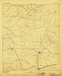
1893 Map of Georgetown
USGS Topo · Published 1905About this map
Georgetown serves as the hub of this 1880s landscape, positioned at the confluence of the North Fork San Gabriel River and its South Fork. This survey captures Central Texas as the railroad network was fundamentally reshaping local commerce and settlement patterns. The International and Great Northern Railroad cuts through the southeastern corner, linking Hutto and Round Rock to wider markets, while the Austin and Northwestern Railroad serves the western corridor through Leander and Liberty Hill.
Find a feature on this map
47 named features on this map. Tap any name to fly to it.
Don’t see what you’re looking for? This feature index may not catch every label — zoom into the map to look around manually.
Map Details
Editions of this 1893 Georgetown Map
5 editions found
Other maps of this area

1885 · Taylor
USGS Topo · 1:125,000

1885 · Bastrop
USGS Topo · 1:125,000

1887 · Taylor
USGS Topo · 1:125,000

1887 · Lampasas
USGS Topo · 1:125,000

1887 · Blanco
USGS Topo · 1:125,000

1887 · Burnet
USGS Topo · 1:125,000

1892 · Temple
USGS Topo · 1:125,000

1893 · Georgetown
USGS Topo · 1:125,000

1893 · Burnet
USGS Topo · 1:125,000

1893 · Bastrop
USGS Topo · 1:125,000