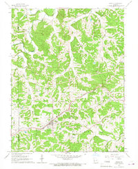
1966 Map of Gerald
USGS Topo · Published 1967About this map
Gerald stands as a focal point in this mid-1960s landscape, positioned along the corridor of the Chicago Rock Island and Pacific railroad. The town's grid is clearly defined, surrounded by the townships of Lyon, Boone, and Canaan. The area is marked by a deep-rooted rural character, evidenced by numerous family and community landmarks such as Bates Cemetery, Gregory Cemetery, and Boeuf Cemetery.
Find a feature on this map
30 named features on this map. Tap any name to fly to it.
Don’t see what you’re looking for? This feature index may not catch every label — zoom into the map to look around manually.
Map Details
Editions of this 1966 Gerald Map
3 editions found
Other maps of this area

1890 · Hermann
USGS Topo · 1:125,000

1903 · Sullivan
USGS Topo · 1:125,000

1935 · Gerald
USGS Topo · 1:48,000

1936 · Hermann
USGS Topo · 1:48,000

1941 · Gerald
USGS Topo · 1:62,500

1942 · Hermann
USGS Topo · 1:62,500

1944 · Gerald
USGS Topo · 1:62,500

1945 · Hermann
USGS Topo · 1:62,500

1946 · Union
USGS Topo · 1:62,500

1948 · Union
USGS Topo · 1:62,500