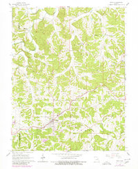
1966 Map of Gerald
USGS Topo · Published 1980About this map
Gerald serves as the primary hub on this Missouri landscape, situated at the intersection of local roads and the Chicago Rock Island and Pacific railroad line. The map reflects a mid-century rural economy where traditional agriculture coexisted with active resource extraction, evidenced by numerous claypits, gravel pits, and quarries scattered throughout the surrounding townships. These industrial sites are frequently found near the many watercourses that define the area, including Boeuf Creek and Big Creek.
Find a feature on this map
30 named features on this map. Tap any name to fly to it.
Don’t see what you’re looking for? This feature index may not catch every label — zoom into the map to look around manually.
Map Details
Editions of this 1966 Gerald Map
3 editions found
Other maps of this area

1890 · Hermann
USGS Topo · 1:125,000

1903 · Sullivan
USGS Topo · 1:125,000

1935 · Gerald
USGS Topo · 1:48,000

1936 · Hermann
USGS Topo · 1:48,000

1941 · Gerald
USGS Topo · 1:62,500

1942 · Hermann
USGS Topo · 1:62,500

1944 · Gerald
USGS Topo · 1:62,500

1945 · Hermann
USGS Topo · 1:62,500

1946 · Union
USGS Topo · 1:62,500

1948 · Union
USGS Topo · 1:62,500